A remotely operated vehicle revisits a Nootka Sound shipwreck this week to probe for a permanent solution to an especially challenging oil spill.
Four months after an all-out spill response got underway, officials are counting on a two-week technical assessment in waters off Bligh Island to yield critical information on fuel still seeping from the 50-year-old sunken wreck of the freighter Schiedyk.
“It’s what we’ve been building up to for the last few months to really ascertain what is down there,” said Gillian Oliver, a Coast Guard incident commander.
An oily sheen in the area was reported by a pilot last fall. Since then, a virtual incident command post — jointly managed by personnel from Coast Guard/DFO, Ministry of Environment and Climate Change Strategy and Mowachaht/Muchalaht First Nation (MMFN) — has overseen containment and cleanup operations in Zuciarte Channel.
COVID-19 safety provisions have complicated matters. A team of about 40 workers is deployed at the site while another 43 staff lend support at various other locations in what amounts to a “virtual command post.” Ehattesaht First Nations fisheries department, Hesquiaht First Nation and Nuu-chah-nulth Tribal Council are also involved in the co-ordinated response.
To date, responders have recovered more than 30 tonnes of fuel, but they need to find a way to stop the upwelling.
“It’s not an easy one, and because it’s in deep water it’s more complex,” Oliver said. The vessel, which grounded on a shoal off Bligh Island before sliding into deeper water, came to rest hull up at depth of 106 to 122 metres (360 to 400 feet). That makes it the deepest wreck involving a fuel spill in Canadian waters in recent years.
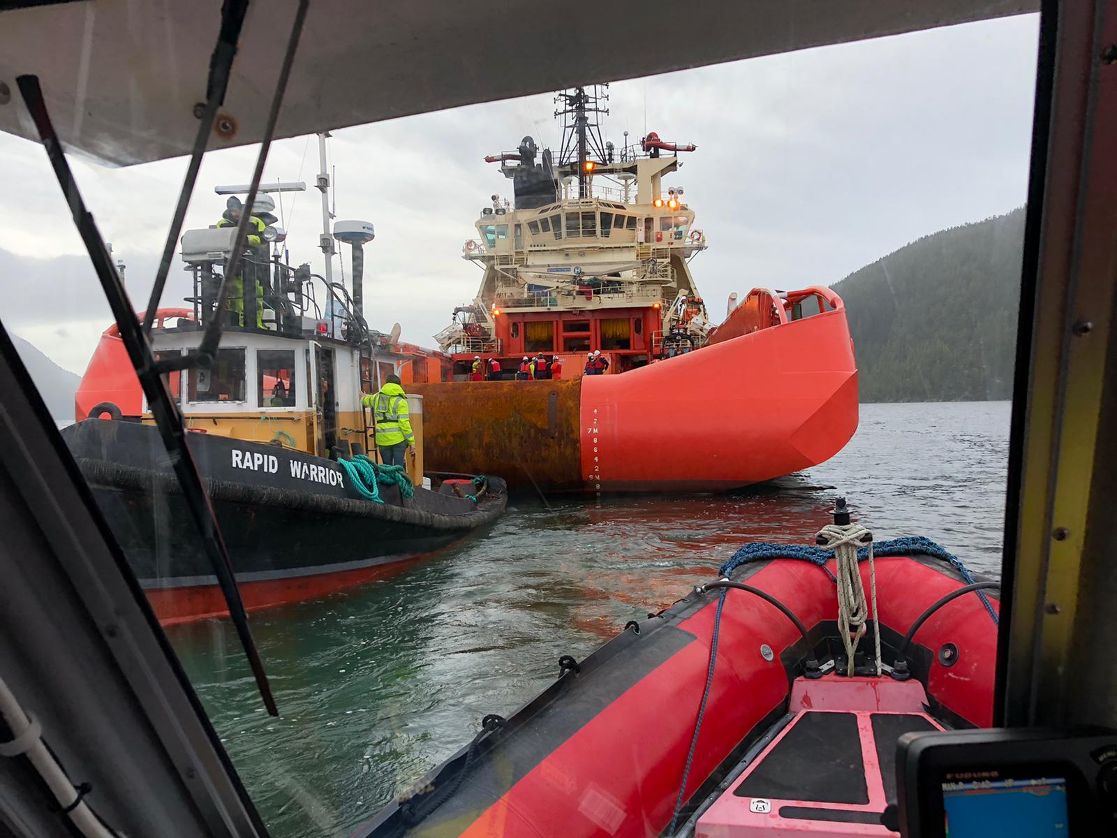
Resolve Marine Group, a U.S. firm that specializes in complex emergency salvage and response, was awarded a $7-million contract to technically assess the wreck of MV Schiedyk. Resolve was involved in cleanup efforts after the massive 2010 Deepwater Horizon spill in the Gulf of Mexico. In 2019, the company raised, repaired and delivered a 420-feet cargo barge in Discovery Passage.
Canadian-registered Atlantic Condor serves as the ROV operations platform while a company from Newfoundland and Labrador supplies a remotely operated vehicle (ROV), essentially the eyes of the assessment.
“It helps inform how we’re going to be able to get the product out,” Oliver said of this latest stage of the spill response. “We need to know what’s left and we need to know where it is.”
There are three primary tasks ahead of them:
- Survey and seal leaks wherever possible.
- Assessment of the hull by ROV, which will map the thickness and integrity of the hull.
- Determine the location of all fuel tanks on Schiedyk and, if possible, sample remaining heavy Bunker C oil and diesel on board.
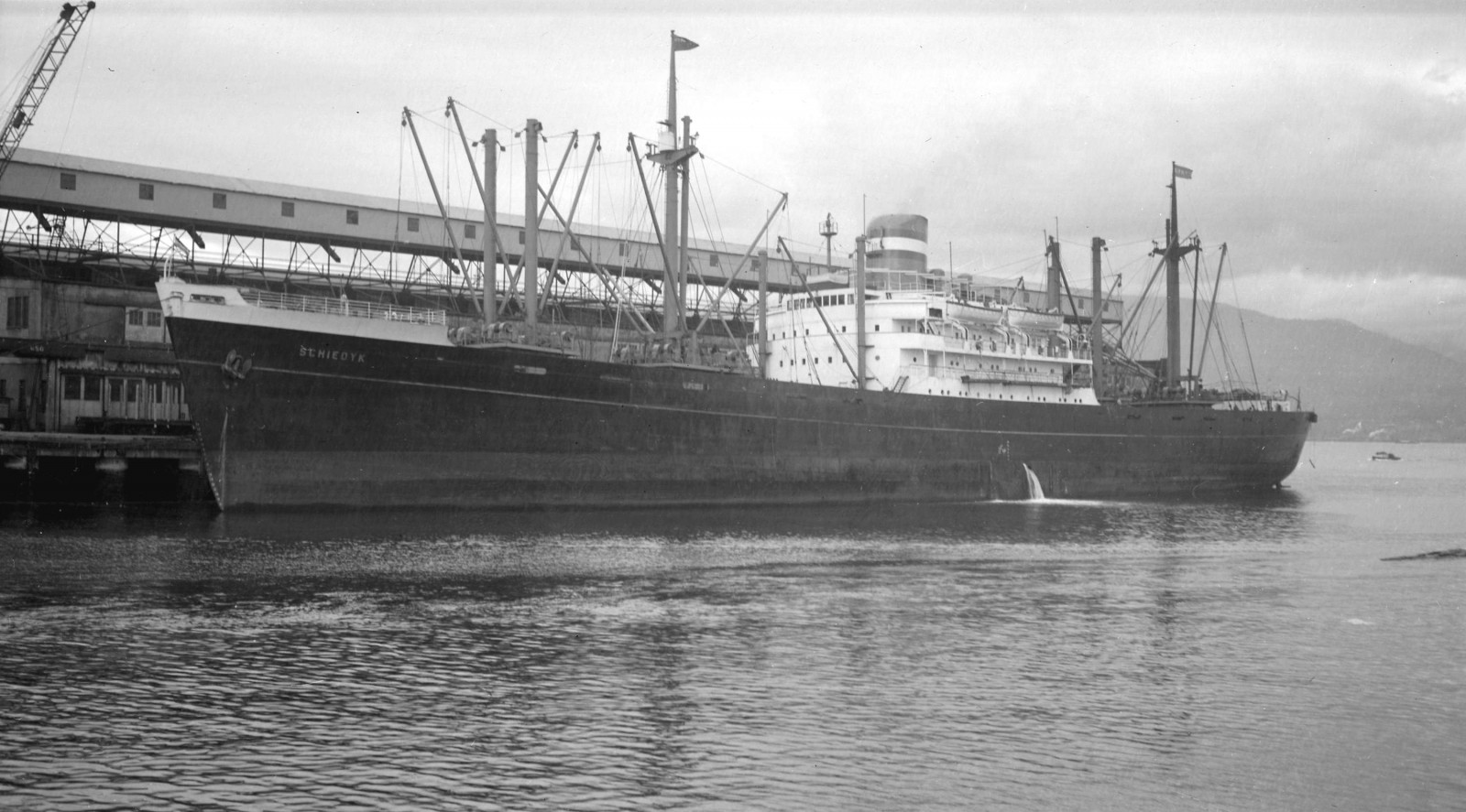
Built in 1949, Schiedyk underwent a diesel conversion in 1960 and there remains some degree of uncertainty over precisely where the vessel’s fuel tanks are located. The Coast Guard consulted archives at Ireland’s National Museum, studying records from Harland and Wolff shipyard.
Bunker C oil is more persistent in the environment than diesel, Oliver noted. The fuel is upwelling at rate of one to four litres per hour, sometimes increasing to 11 to 13 litres per hour.
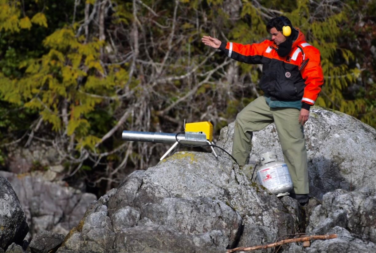
Fuel containment and recovery has been especially important at Bligh Island, located in an ecologically sensitive area of the coast, a migratory pathway for birds and mammals. Wildlife monitoring and sampling suggests the impact so far has been minimal.
“I would say we’ve been very successful at mitigating the impact to the marine environment and wildlife,” Oliver said. “I think we had one slightly oiled mew gull.”
She figures there may have been a much greater impact had the oil spread over a larger area.
Mowachaht/Muchalaht members have played an instrumental role in “EU,” the Environmental Unit responsible for tasks including shoreline cleanup assessment technique (SCAT), net environmental benefit analysis and surveying resources at risk. Traditional knowledge and experience specific to the area are integrated with science, according to the Unified Command information site.
Workers on site are ready to respond to any increased risk during this latest phase, having added protective booming, mobilized equipment and added monitoring in case any patching work increases upwelling from the wreck.
“There is a small, increased risk when they’re down there trying to patch up the leak,” Oliver said.
Wash from vessels passing by could disrupt the position of the operating platform, so it’s more important than ever that boaters stay clear of the emergency zone in Zuciarte Channel over the coming weeks, she noted. They have seen a few more boats lately.
“We do have an emergency zone established,” Oliver said. “It is getting into fishery season and better weather. Try to stay away from Zuciarte Channel.”
The technical assessment could take a couple of weeks or more, depending on weather conditions and barring any unforeseen issues. Weather has generally been favourable through the winter despite the exposed location.
“There haven’t been too many weather delays,” Oliver said.
There has not been a definitive explanation for the freighter’s sinking in January 1968, although the captain reported difficulty steering as they exited the channel. Captain and crew were rescued.
“I understand it was a foggy night,” Oliver said. “Clearly there was a course correction that didn’t happen.”
Insurer Lloyds of London wrote off the wreck and paid out the value of ship and cargo to Holland America.


