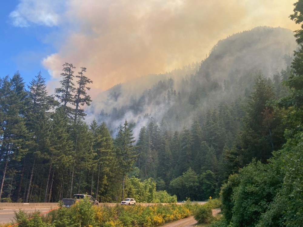
With a forest fire still smoldering on the slope above, Highway 4 will be closed for another week and a half, according to an update from the provincial government on June 13.
In a midday press conference delivered by Rob Flemming, B.C.’s minster of Transportation and Infrastructure, a tentative reopening date for the weekend of June 24 was announced, allowing firefighting crews to further dampen the Cameron Bluffs wildfire while the hazards of a compromised mountainside over the critical highway corridor are assessed.
First discovered on June 3, the wildfire by Cameron Lake has burned 254 hectares, forcing the closure of Highway 4 after three days of growth. But some rain over the weekend of June 10 and the continued efforts of as much as 76 ground personnel at one time plus four helicopters has caused the fire to remain within containment lines, being downgraded from “out of control” to “being held” by the B.C. Wildfire Service on June 13.
Now the focus is shifting to ensure the future safety of the highway.
“They need to make sure that the cliff face is stable, and that the highway and the people who use it are protected,” said Flemming.
When the highway does open, the ministry plans to introduce single-lane alternating traffic with a metal fence held by cranes along the sections where falling debris is most likely.
“We do expect some significant delays,” said Janelle Staite, deputy regional director for the Ministry of Transportation, during the press conference. “This still needs to be essential traffic only.”
The Ministry of Transportation expects the single-lane-alternating scenario will continue until mid-July, when the normal opposing double-lane traffic is planned to resume. Until then, only essential travel is advised.
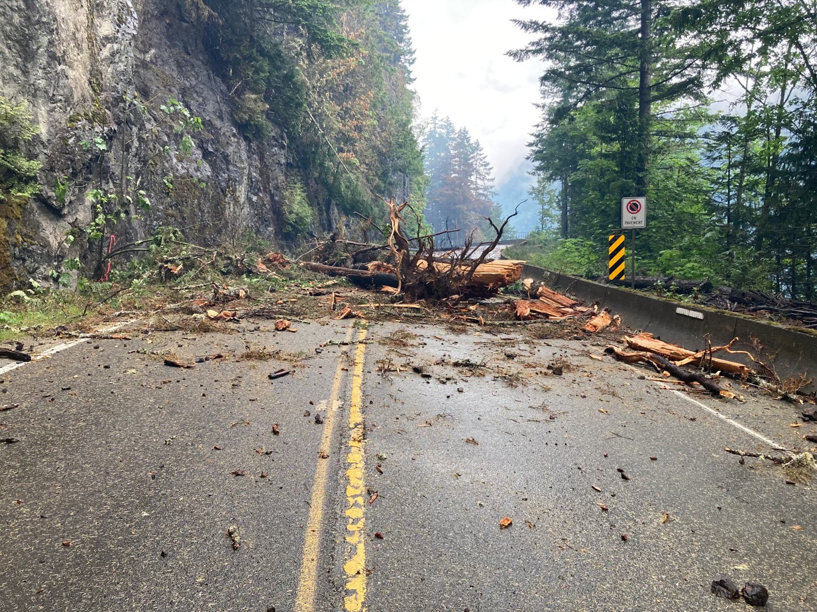
The Cameron Bluffs fire has spread along a kilometre and a half of the highway, causing nearly two-dozen trees to fall on the road, some of these old growth stands measuring up to a metre in diameter, said Staite. Even on the morning of June 13 rocks the size of coffee mugs were still seen falling on the highway, she said. The most hazardous area is around Angel Rock, a large rock face at a curved section of the highway along Cameron Lake.
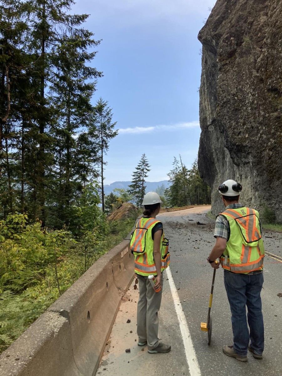
“In and around that area is where we see the bulk of materials continuing to come down now,” said Staite. “The slope itself remains intact, however the debris on top of the slope has been loosened as a result of the wildfire, and that is the piece we are concerned about from a technical perspective.”
Staite explained that due to the rocky nature of the slope landslide is not a foremost concern, but the risk of falling debris will require more attention over the coming weeks. Assessors with the B.C. Wildfire Service have progressed over halfway up the steep slope affected by the blaze, tagging danger trees that need to be removed to ensure safety on the highway.
“It is very challenging topography they are working in, and a very significant concern for debris coming down onto Highway 4,” she said. “We do acknowledge that there is an upcoming weather system coming in later this week on Thursday, we do anticipate seeing some rain there that may slow the efforts of both the assessment as well as the falling of the trees that are needed.”
Aerial images of the area affected by the fire show a mix of red and green trees. While the red stands have been completely burned, many of the green trees could also be more affected than they appear, explained Staite.
“The green ones haven’t necessarily candled all the way up to the top, but we have heard from B.C. Wildfire Service that those trees are burning - actually in some cases from the inside at the root levels,” she said.
Despite the falling debris, Highway 4 remains intact along Cameron Lake, although some concrete barriers have been dislodged as the forest fire has progressed. Currently the Ministry of Transportation awaits clearance from the Wildfire Service for contractors to undertake a more detailed analysis of damage to the road.
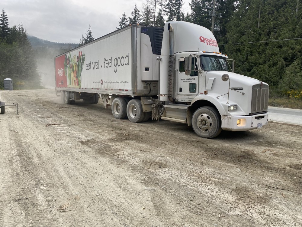
In the meantime, Port Alberni and Vancouver Island’s west coast communities will continue to rely on a detour route for essential supplies, which runs on logging roads from Port Alberni, past Nitinaht Lake, to Lake Cowichan. Using a combination of privately owned industrial roads and forestry service routes, the detour was established after the closure of Highway 4 to ensure the passage of essential supplies and travel.
“There have been some improvements on the current alternate route, which is why it was selected, that make it the most drivable, desirable alternate that we could open,” said Flemming.
Since June 6, 550-1,000 trips have been made each day on the detour, 20 per cent of which are commercial vehicles moving supplies like fuel and food. This compares to the 15,000 trips that normally occurred each day from Port Alberni to Parksville on Highway 4 in the summer.
Pilot vehicle-guided convoys are now being coordinated for the movement of essential commercial supplies, two of which leave each day from Lake Cowichan, while another two leave from Port Alberni. With 13 single-lane bridges on the detour, other vehicles are asked to allow these approaching convoys to pass to ensure the timely transport of essential goods.
“What it helps with is to warn motorists of those vehicles approaching,” said Staite.