With a “tropical” rainstorm impending, Tseshaht First Nation activated an emergency response plan to prevent the sort of damage incurred in recent years.
On Tuesday afternoon, with at least three more days of heavy rain in the forecast, Ha-Shilth-Sa spoke with Tseshaht leaders to see what steps the nation is taking.
“We have been taking part in the conference calls with Emergency Management B.C.,” Tseshaht Elected Chief Councillor Cynthia Dick said. “We are currently at the ‘Warning’ Level, where you start making preparations if you are potentially going to be impacted. The [Emergency Operations Centre] will be set up, and sandbags have been ordered.”
Dick noted the past few years have seen significant flooding. The year 2014 could be described as "catastrophic," while 2016 was “serious,” but not to the same level of damage.
"Last year, we took part in the conference calls, and they predicted that it was going to be at the same level, if not higher, than in 2014. So we were well prepared for that one, and we had a lot of great community support, in getting the sandbags out, and making sure that pumps were at the [designated] homes, and making sure that for any detours, we had plans in place.”
On Tuesday, Tseshaht Emergency Preparedness chair Hugh Braker was in Ottawa, monitoring events by telephone and email.
"We have activated our Emergency Operations Centre. We're at Level One. At this time, we are getting resources together, and putting them on standby for potential flooding starting tomorrow (Wednesday.)
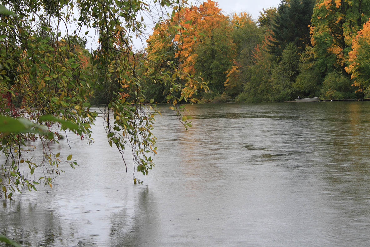
"The river has climbed throughout the day today. It is in people's back yards, but it is not yet threatening homes. We do expect that with the next pulse of rain, that it will become a problem. The rain is expected to continue till Monday. And that is quite serious for us.
"We had 80.5 millimetres of rain on Sunday. That put everything up to [water-holding] capacity, and saturated everything. From here, everything has to run off.”
Perhaps more ominous, Braker said that on Monday he was advised by BC Hydro that the Elsie Lake Dam was three metres below "overspill."
"So, as of today, if Elsie Lake Dam is not spilling over the top, it will be shortly," Braker said. "We had an emergency call yesterday. BC Hydro was on the call.
"We have been advised by the River Forecast Centre to expect flooding equal to last year, and possibly worse.”
As of Tuesday mid-afternoon, Dick said no flooding had been reported thus far.
"But there are people on the river who are concerned. We know those houses that tend to flood, so it is about making sure those ones are ready," she said.
Those who live in the Watty's Hill neighbourhood (especially elders and children, or people with exiting medical conditions) are at an increased danger of becoming isolated, due to road flooding and closures, Dick said. And those who live on the river and have previously experienced serious flooding will be evacuated before it comes down to a boat rescue, she added.
Braker noted that last year flooding forced the closure of Highway 4 at Watty's Hill, and a number of homes had to be evacuated. "But we managed to keep damage last year to a minimum," he said.
"In 2014, the flooding was catastrophic. In particular, we had two homes that suffered $60,000 damage, and we had numerous other homes that suffered less damage. We're hoping we're not going to get that this year.
"I have advised all of the NTC tribe that it is possible that Highway 4 will be closed at some time over the next few days. At least at Watty's Hill. It depends on how high the water goes. If it does go higher, we could be looking at more extensive closures.”
Braker noted that Environment Canada had projected that the region would receive 50 to 60 millimetres of rain each day for the next few days.
"We are in what is commonly called the 'Atmospheric River' right now. Today's storm and tomorrow’s are 'Tropical.' So they are not a 'Wind' event, but they are a 'Heavy Rain' event,” Braker explained.
Braker said to date, there has been no attempt to remediate potential flooding sites.
"We have applied to look at having a study to see what we can do to lessen the risk,” he said.
Tseshaht faces an additional hazard besides the initial flooding. That is erosion.
"Some places on our reserve have lost five feet from erosion," he explained. "So we have to look at both flood prevention and erosion prevention. We don't have the grant for that [study] yet."
Yet another hazard is landslides. Last year, a landslide on a logging road required extensive remediation, and further slippage is expected.
"We're looking at 18 homes that are going to be affected by flooding by [Wednesday]. That would include a few homes that are going to become isolated. We are looking at potential evacuations starting later on [Wednesday]. We have numerous elders and people with chronic health problems living along the river. They will be our first priority.”
Braker said that, for the moment, he would remain in Ottawa, pending further developments.
"If it gets much worse, I will be on the first plane home from Ottawa,” he said.
Braker noted that the warning is out for the entire Island, which means all Nuu-chah-nulth Nations.
"This is an event at is going to an event that affects all Nuu-chah-nulth,” he said. "I have advised all of the NTC tribes that it is possible that Highway 4 will be closed at some time over the next few days. At least at Watty's Hill,” he said. “It depends on how high the water goes. If it does go higher, we could be looking at more extensive closures.
Dick said she knows Tseshaht will stick together and help each other out in the coming days.
"We are always appreciative of the community when they come together to support each other. We are extremely grateful to them."


