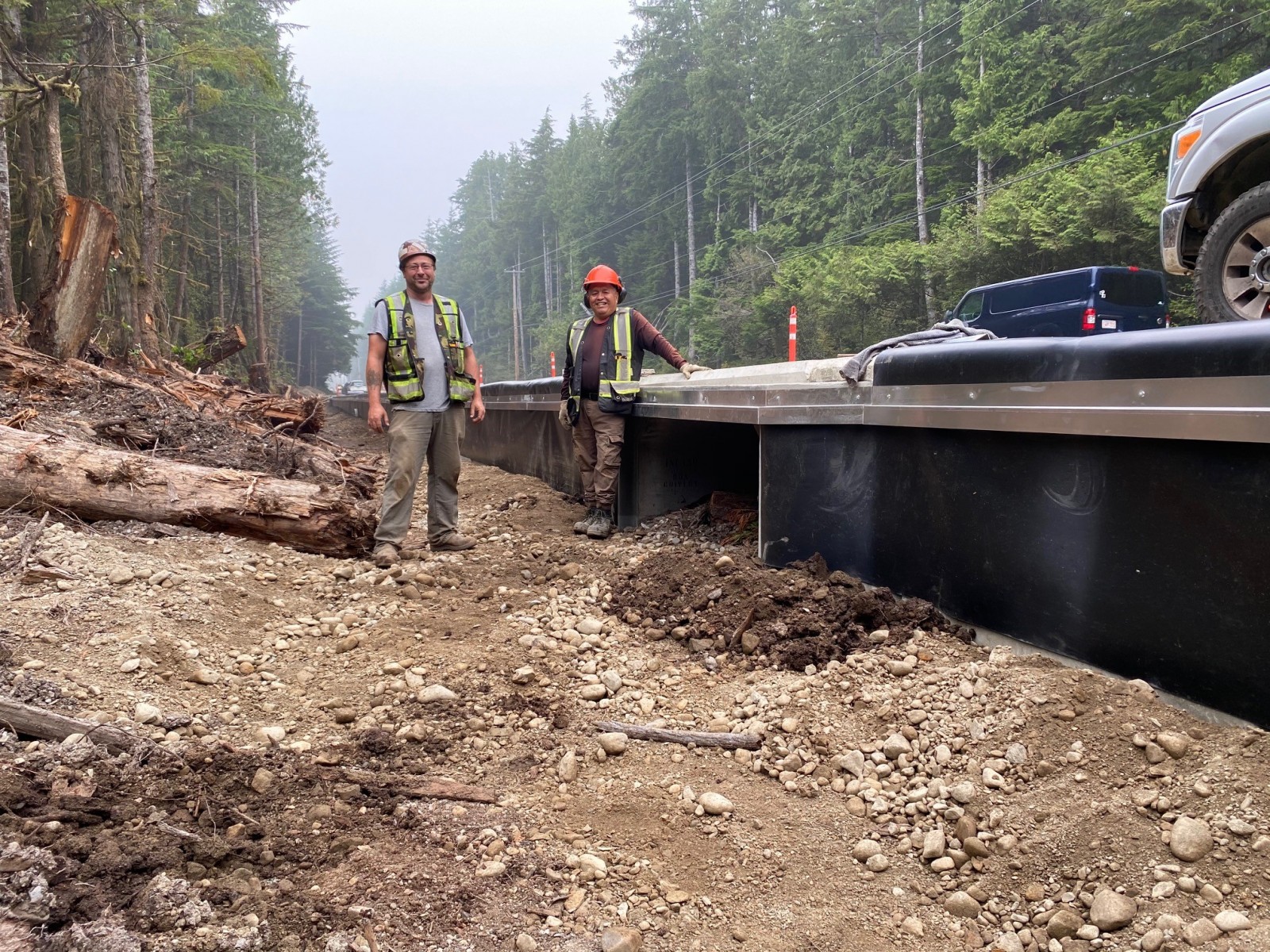
West coast residents and visitors alike are advised to “proceed with caution” while using a 25-kilometre multi-use pathway, part of which is still under construction through Pacific Rim National Park Reserve.
The $51-million ʔapsčiik t̓ašii (pronounced ups-cheek ta-shee), located within the hahuuli of Tla-o-qui-aht and YuułuɁiłɁatḥ First Nations, is scheduled for official opening in spring 2022, but Parks Canada announced a partial or “conditional opening,” June 21 on National Aboriginal Day.
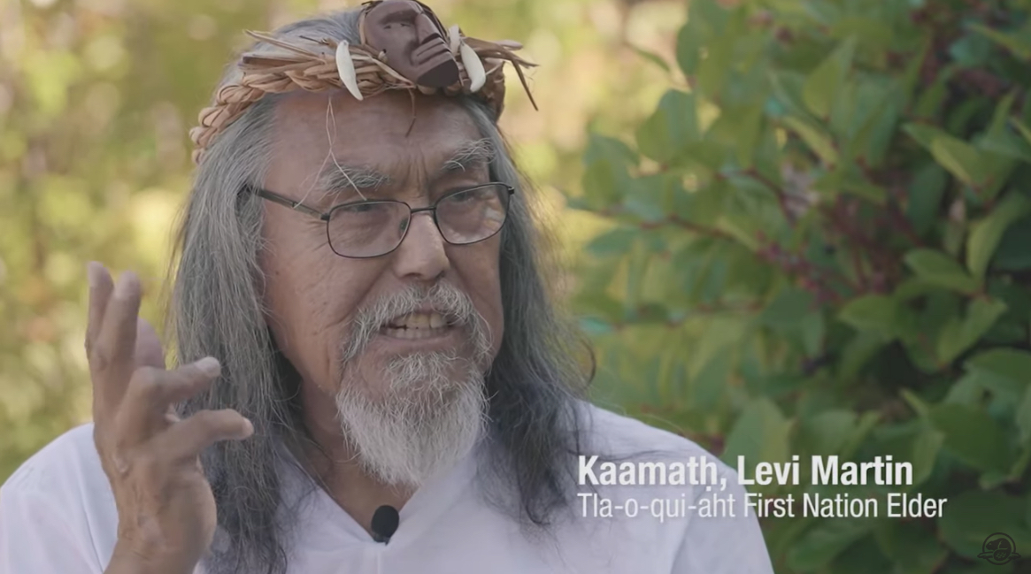
In conjunction with the soft opening, Parks Canada released a five-minute video, Building ʔapsčiik t̓ašii: Creating a Pathway Together, which tells the story of the pathway’s design and development through careful guidance from a working group of elders.
People have been taking advantage of the new link between communities for some time already, said kweesh kweesh ata aqsa, Tammy Dorward, First Nations program manager at the park.
“Since it’s been paved it has been utilized, and so there was a discussion at the park on how to proceed,” Dorward said.
Park administration recognized it would be difficult to keep people off the pathway until its official completion. A conditional opening comes with a set of eight advisories intended to ensure safety and privacy of communities along the route as final construction continues.
“There is still lot of work to be done out there,” Dorward added.
In late spring, Parks Canada contracted IWS Excavation to build a final three-kilometre section of the pathway called Wayii (meaning hill) on the escarpment overlooking Long Beach between Green Point Campground and parking lots at Long Beach. That last stretch should be finished by fall.
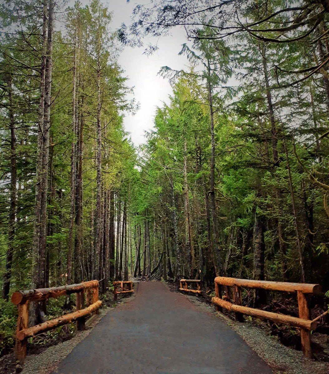
For much of its length, ʔapsčiik t̓ašii parallels Pacific Rim Highway through the park, meandering through rainforest and along foreshore, and passing near the Tla-o-qui-aht villages of Esowista and Ty-Histanis.
Pathway travellers are asked to remain on the route to respect communities and to protect sensitive ecological areas. Occasional highway pullouts connect to the pathway, allowing motorists to park and travel the pathway in sections.
Additional work on visitor amenities, interpretive panels and trilingual signage continues into next year, along with restoration, which includes removing invasive species, replanting with native species and adding wood-chip borders to the pathway.
In the meantime, trail users are asked to respect the rules.
“The idea is to proceed with caution,” Dorward said. “We’re asking all visitors to stay on the trail, to respect community privacy and not be walking through them.”
Trail users may encounter construction crews at any point along the route and should be prepared to encounter wildlife as well. They are also urged to use extreme caution at uncontrolled highway crossings near Radar Hill and Wick Road.
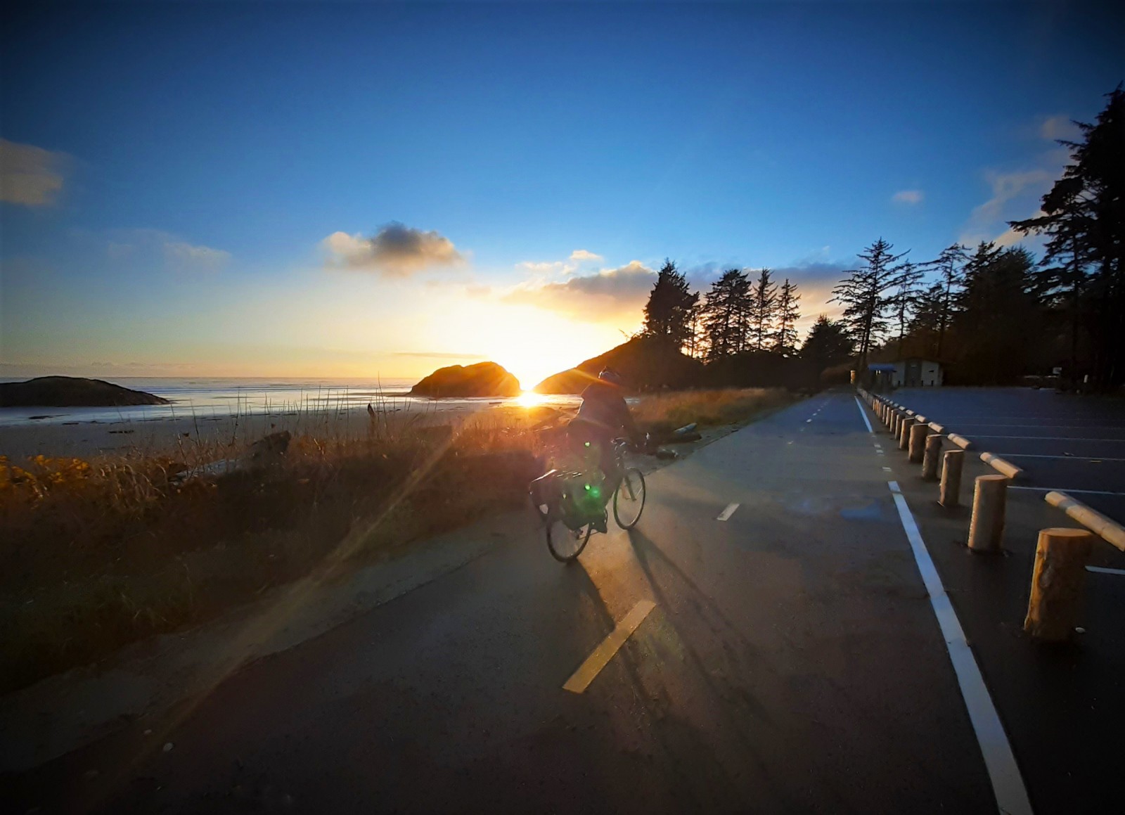
Dorward said she has seen many people from First Nations and the two neighbouring municipalities cycling the route.
“I’ve heard great excitement from people biking the trail, from people wanting to use the trail,” she said. “People are using it, and it’s a great way for people to have an alternative transport for work.”
Louis Maddiford, co-owner of Ukee Bikes in nearby Ucluelet, said there has been an increased interest in cycling recently, a trend he thinks was spurred by pandemic isolation and the need for recreation alternatives, as well as the new pathway as it nears completion.
“People are understanding the benefits from this,” Maddiford said. “Lots of people are trying it out.”
Pedalling the entire route is the equivalent of a 25-30 kilometre road trip and will probably appeal most to avid cyclists, he suggested. On the other hand, pedal-assist electronic bikes are increasingly popular. Only Class 1 e-bikes — those without a throttle — are permitted on the pathway. That rule will help to ensure safety by restricting speed.
“Practically everything we do is Class 1 — none of our motors is throttled — so they’re allowed on the trails,” Maddiford said. The maximum speed of a Class 1 e-bike is 32 kilometres an hour.
Saya Masso, natural resource manager with Tla-o-qui-aht First Nation, said the pathway will encourage more people, including youth, to take up cycling for “participaction and fresh air.”
“The trail serves as its own youth programming in a way,” he said.
There are no cycling paths where he lives at Opitisaht on Meares Island, so the pathway is a welcome addition as a recreational asset and a safe alternative to cycling the highway, Mayo said.
“I know that sentiment is echoed throughout,” he said, adding that he looks forward to taking his kids for rides.
For years, local residents have wanted a path to connect their communities, a safe alternative to Pacific Rim Highway, often a busy route. In February, Tofino completed a link to the pathway, a $3.9-million, 2.8-kilometre addition to the municipality’s multi-use path. At the south end of the park reserve, Ucluelet was unsuccessful in its bid for grant funding earlier this year but remains committed to providing a similar link.
The video production, Building ʔapsčiik t̓ašii — https://www.youtube.com/watch?app=desktop&v=Bv0trpgEXMM&feature=youtu.be — presents the pathway in fullest form, not only as a vital community link but as a cultural showpiece and teacher in the making.
“In our language it has two meanings,” Levi Martin, Tla-o-qui-aht elder, explains in his introduction. “Ups-cheek is going the right way on a path and, also, Ups-cheek means to make sure you speak the truth. That was a very important teaching for our people, that you speak the truth.”
“You know, you could survive out there all day without bringing lunch from home and we want it to stay that way,” adds Marg Touchie, YuułuɁiłɁatḥ elder, later in the video. “We want everything in that area to stay as natural as possible.”


