After a summer of extreme drought, experts are concerned for conditions next year as they predict mild winter weather, with a November precipitation deficit.
Armel Castellan, a warning preparedness meteorologist with Environment and Climate Change Canada, says the last several weeks have seen less precipitation than a typical fall.
“There's actually going to be a deficit in November, which is the wettest time of year for the coast,” he said.
“We’re not going to hit our numbers this month,” added Castellan. “We'll have to see how December, January, February go.”
According to Castallen, this year the El Niño-southern Oscillation phenomena is in “full force”. It started a few months ago, though Canada won’t feel impacts until around Christmas. An El Niño is a phenomenon characterized by higher ocean temperatures at the equator with weaker trade winds, resulting in warm weather patterns on the West Coast of the Americas.
“That [phenomenon], when it's in its positive phase, so the El Niño phase, not the La Niña phase, is a very strong driver for both hemispheres,” said Castellan. “We do expect, overall, the probabilities are relatively high for all of Western Canada to see a milder winter.”
According to the National Oceanic and Atmospheric Administration (NOAA), the El Niño has a 62 per cent chance of lasting through April to June of 2024.
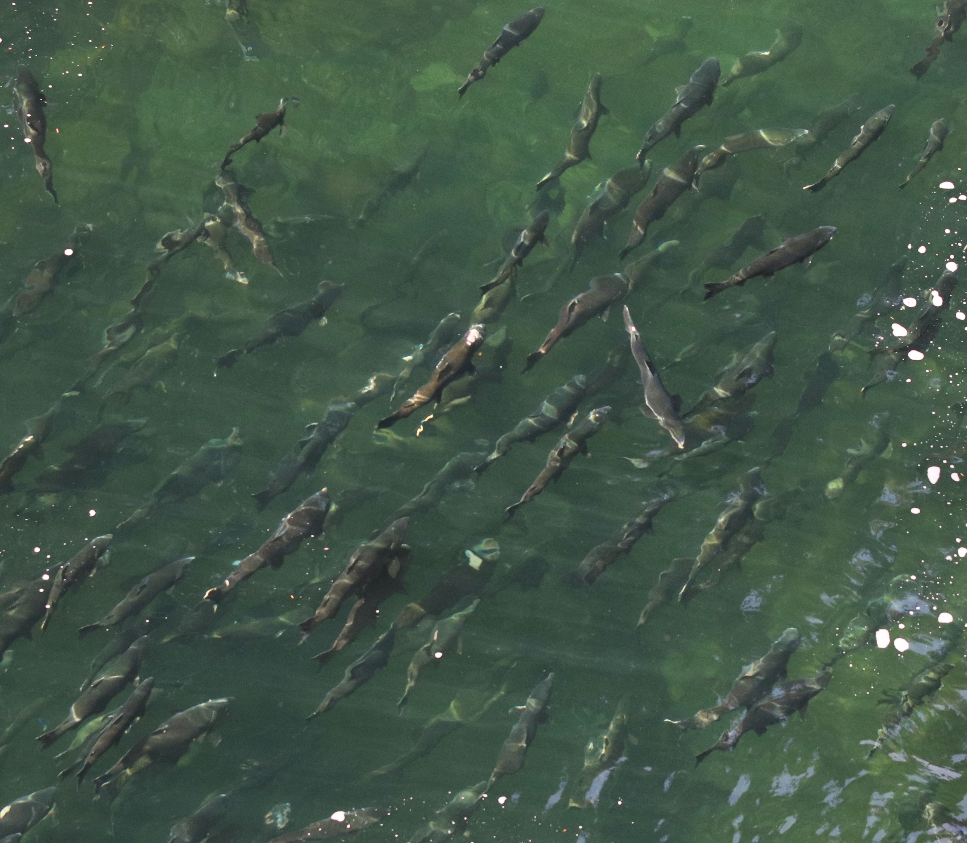
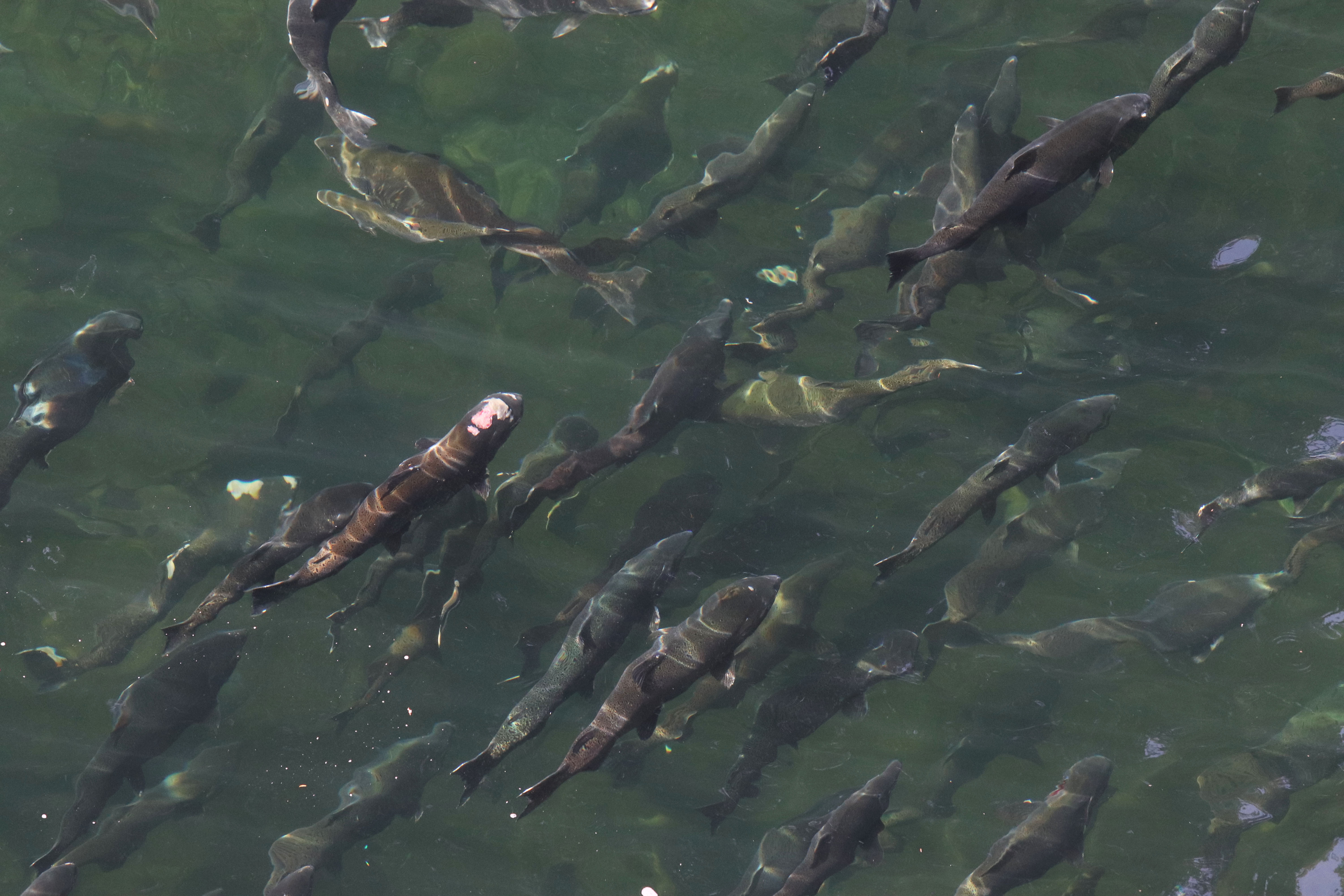
Graham Murrell, a biologist the Hupačasath fisheries manager, looks back on the 2015/16 El Niño.
“A lot of the indicators are showing that we may be in a similar situation,” he said. “Which would mean not much snowpack, and probably a hot, dry summer.”
In 2015, Murrell shared that the season saw hot weather, warm river waters, delayed migrations, and a high mortality rate of salmon.
“We're already starting some discussions on tools and early indicators where we can take action, if needed,” he added, for Stamp and Sproat Rivers.
“As we've seen, most summers recently have been extremely dry, and not just at the peak of summer in July and August, but also starting quite early,” said Castellan. “This past year, we saw warm July temperatures in the month of May, which was quite extraordinary.”
“It led to wildfires right across the country, and particularly in Western Canada,” he continued. “The dryness or the drought signal is quite strong and expanding into the shoulder seasons.”
As reported by the Coastal Fire Centre, since April of 2023 the coastal region has seen a total of 365 wildfires. In 2022, there were 298.
“One of the things that we really did notice this year, in particular, is that we entered the fire season under drought-like conditions,” said Jade Richardson, a coastal fire information officer. “We stayed in drought-like conditions for much of the summer.”
“We had very little rainfall… in the fall and winter of 2022, into early 2023 on the coast, and it just contributed to drought-like conditions that allow easy start and allow fires to grow much more quickly,” said Richardson.
“Winter’s where we generate our storage for the next season,” said Murrell, reflecting on how winter conditions contribute to overall river health and salmon runs. “If you have a strong snowpack, you can help to weather those warmer, drier periods, [and] can get you nicer, cooler flows longer into the summer, especially for our runs… they'll start in April, May, June.”
“With a good snowpack it can push us right through the whole migration season, and get us through safely,” Murrell continued. “That snowpack is pretty key for, especially that early summer, and into the mid-summer range, that can keep our rivers fuller and cooler.”
After this year's drought, the Ministry of Land, Water, and Resources stated that coastal B.C’s early fall has returned to “more seasonally typical conditions''. According to Estavan Point, a long-term climate station on the west coast of Vancouver Island, it was reported that precipitation rebounded by roughly 95 per cent, though remaining below average.
“Across much of the province, by summer 2023 the deficit in precipitation and streamflow was so substantial that even when late summer/early fall storms began to arrive, streamflow increases were generally very muted - much lower than would be expected for the precipitation totals,” wrote the ministry in an email to Ha-Shilth-Sa. “For example, when drought conditions were near peak in the late summer, the Estavan Point… indicated over one metre of precipitation deficit for the preceding year, with a period of record of over 100 years.”
“Much of next year’s drought story is as-yet unrevealed, dependent on the upcoming winter and spring precipitation,” wrote the ministry.
Castellan noted that warm and dry conditions are “bleeding” from the summer season into the spring and fall.
“I’m also saying that at times we see inactivity in the wet season,” he said. “That’s currently what we’re seeing, which is why folks like ourselves, the River Forecast Centre, agriculturists, First Nations, biologists, [and wildfire services]; everybody is very concerned… about what this means for next spring and summer.”


