After a summer of severe drought, Vancouver Island went from one extreme to another this week with the first storm of the autumn.
But despite the late September downour that hit the West Coast - brought by what meteorologists called a ‘bomb cyclone’ - after a year of lower-than-normal precipitation some are reluctant to say the drought is over.
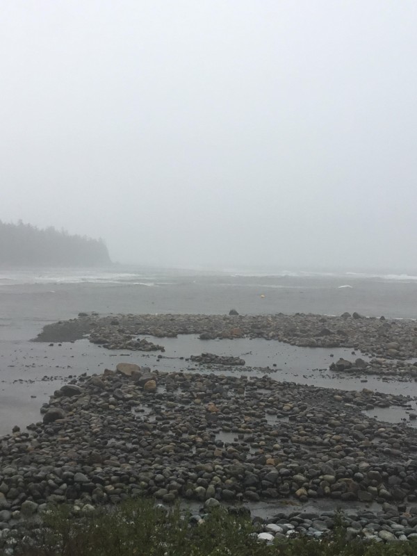
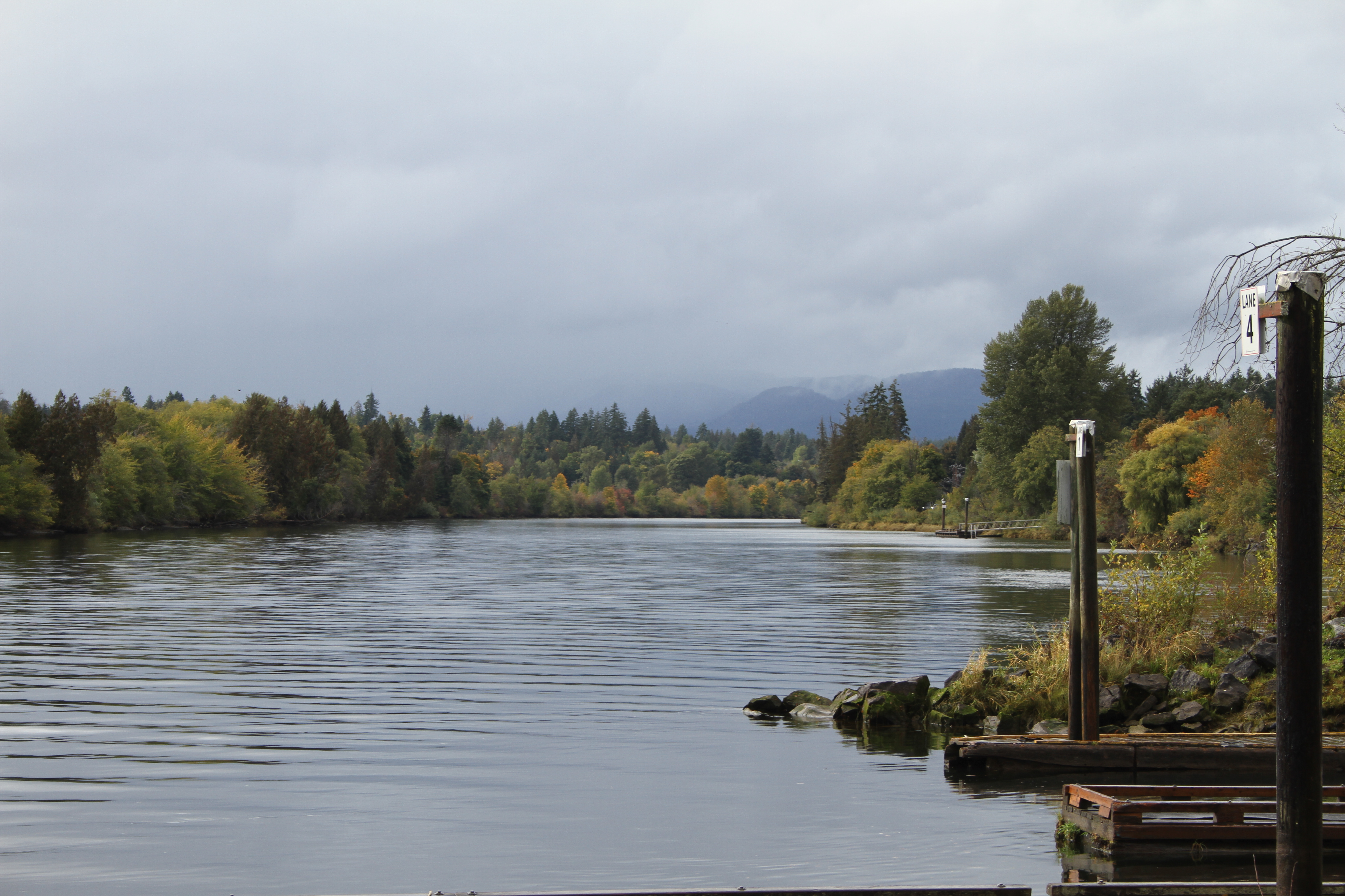
Heavy rain and strong wind hit the West Coast on Sunday evening (Sept. 24), soaking Vancouver Island’s parched land until Tuesday, Sept. 26. This put all of Vancouver Island and the southern B.C. coast under a “high streamflow advisory” according to the River Forecast Centre, which advised people to avoid fishing, using boats or hiking near high flowing rivers. As much as 150 millimetres of rain was expected to hit some parts of western Vancouver Island.
“Current river levels are extremely low in most areas,” read a notice from B.C.’s Ministry of Forests. “Conditions are expected to be dynamic with periods of rapid river rises. Being near these riverbanks, creeks and fast-flowing bodies of water is dangerous.”
This was brought on by what meteorologists called a ‘bomb cyclone’: the rapid intensification of a low-pressure system in a short period of time.
Winds had peaked by Monday afternoon (Sept. 25), reaching 70 kilometres an hour in Tofino, while north of Kyuquot the Solander Island Lightstation at Brooks Peninsula recorded 161-kilometre gusts. Environment Canada reported a “gale warning in effect” and a “waterspout watch” for the island’s northwest coast.
At the northern end of Clayoquot Sound In Hesquiaht Harbour, the much-needed rain finally enabled the Ignace family to get enough water in their well to automatically gravity feed into the household tank. But the family’s boats needed multiple lines tied to them to ensure the vessels didn’t get dislodged from the harbour, said Dianne Ignace.
“The boats have five bow lines and four stern lines tied to them and the wall,” she wrote in an online message to Ha-Shilth-Sa. “The tide doesn't seem to want to go out. The boats hardly stop floating long enough to bail them out.”
Ignace expected more rough weather the following weekend, with 12-foot tides at the coastal settlement.
“It is extremely rough with really lots of much needed rain,” she wrote. “The river is huge and the cohoes are streaming up by the hundreds. I'm filling my 13th jar today.”
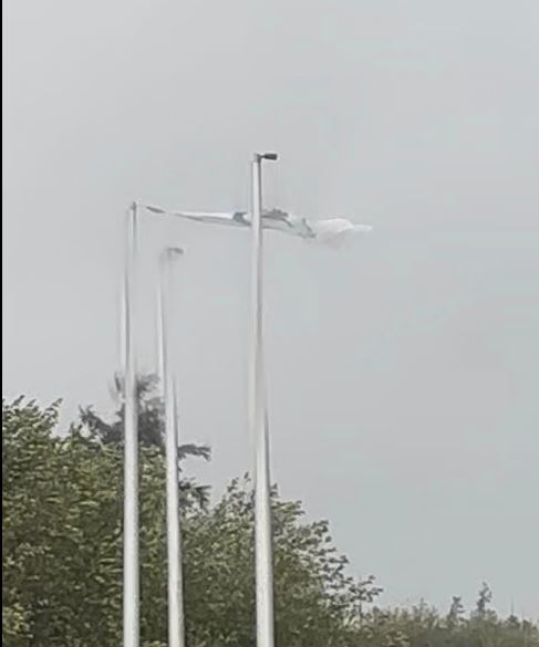
Meanwhile pictures had surfaced on social media of strong winds in Ahousaht, where Nate Charlie posted a photo of the First Nation’s flag almost completely blown off its mast in the community’s newer subdivision.
In the Alberni Valley the highest number of chinook salmon were expected to pass through the Stamp River, said Graham Murrell, fisheries manager for the Hupacasath First Nation.
“They started marching at 1,000 per day back in the end of August,” said Murrell of the daily passage of chinook along the Somass and Stamp River system. “Around the 23rd of August it’s pretty much been a conveyor belt of fish.”
As the sudden rain persisted, the First Nation’s fisheries team closely watched river levels.
“We’re kind of on river watch right now on the Stamp River making sure our tunnels aren’t going to be flooded out,” said Murrell as he observed the area’s rivers on Sept. 26. “Just this morning they shot up 15 centimetres. But it’s got the fish moving, though.”
As is often the case during storms, coastal communities suffered power outages. In Tofino 317 homes and businesses lost power from 4:30 p.m. Sunday until noon the next day, an outage that also affected Ahousaht. In Ucluelet over 500 homes and businesses were without electricity from 10 p.m. Sunday until 5 o’clock the next morning.
These outages were caused by trees and branches falling on power lines, said Ted Olynyk, BC Hydro’s manger of community relations.
“It’s the first storm, luckily it wasn’t as bad as it was forecast, so we should take that as a blessing and a reminder that we always need to be prepared for outages,” he said. “From my experience people on the west coast are quite hardy and are able to deal with outages much better than other parts of the island.”
He noted that repairs cannot always be immediate during heavy storms.
“There are times when we bring crews in and tell them just wait until the intense part of the storm has passed,” said Olynyk. “We don’t want to put anybody in harm’s way.”
Heavy rain is characteristic for western Vancouver Island, particularly Hucuktlis Lake, formerly known as Henderson Lake in Uchucklesaht territory. From Sept. 23-26 Hucuktlis Lake received over 370 millimetres of rain, a large volume but not an abnormal event for the rainiest place in North America, which saw a record precipitation of over 9,300 millimetres in 1997.
For many, the first storm of autumn brought a welcome change from the driest summer in recent memory. Since July 13 the province had Vancouver Island under drought level five, resulting in low water flows later that month in the region’s rivers. The District of Tofino reported 75 per cent less rain than the average summer, resulting in a ban on all outdoor watering since early July, with notices for homes and businesses to take other measures to conserve water.
But after much of the island was under a “extreme fire danger rating” over August, the Coastal Fire Centre had this downgraded to “very low” for most of Vancouver Island and the southern B.C. coast. On Sept. 26 a ban on campfires and outdoor burning was also lifted, prohibition that had been in place since early June.
Despite the overnight transformation in weather, Natasha Cowie, a hydrologist with the Ministry of Forests, was reluctant to conclude that Vancouver Island’s drought conditions are over.
“It’s preliminary to say the drought has been ended because it was such a profound drought,” she said. “We need repeated events like this, repeatedly for weeks, to catch up to more normal conditions.”
This summer’s drought had been a year in the making, explained Cowie, after the West Coast had been experiencing lower-than-normal precipitation since last fall. Over the past 12 months this has created precipitation deficits below the median volume in coastal locations. Port Alberni’s weather station currently has a deficit of 650 millimetres, while the Estevan Point station near Hesquiaht Harbour has a shortfall of over one metre of rain over the past year.
“It’s at the lowest precipitation ever recorded, and that’s for a period of record going back to 1909,” said Cowie of the coastal weather station, noting that other Vancouver Island locations are also behind in cumulative precipitation. “Really there was not meaningful recharge to groundwater and to streams through the winter.”
Although the change brought by the ‘bomb cyclone’ was abrupt, storms of this magnitude are seasonally typical for the West Coast, said Cowie. Stream beds and other areas are accustomed to the heavy rain.
“This is going to be very different on the west coast of Vancouver Island than a proportionally similar storm in the Interior,” explained Cowie. “This is not an atypical amount of rain for the area, so the streams’ geomorphology has adapted to heavy rainfall, and also adapted to really abrupt increases in stream flow because all of these systems are essentially dominated by rainfall.”