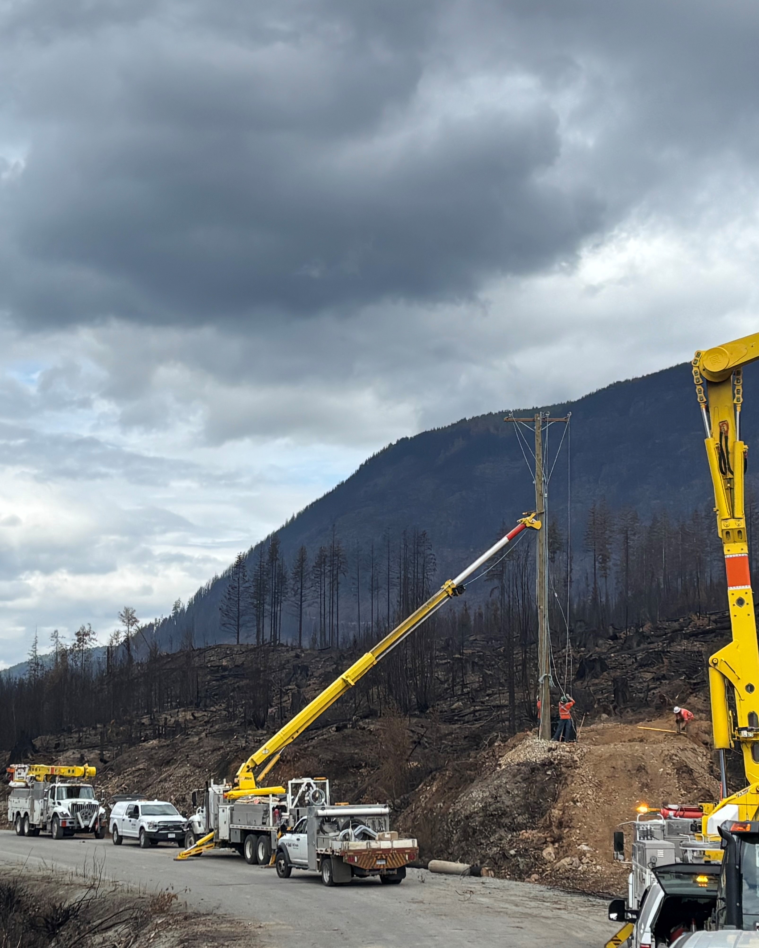
Power has returned to the Bamfield area and Nitinaht, but the road to the communities will remain closed longer than anticipated “due to unsafe conditions” caused by the Mount Underwood wildfire, says the province.
On Saturday, Aug. 23 the lights went on again for Bamfield, the Huu-ay-aht village of Anacla and the Ditidaht village of balaac̓adt at Nitinaht Lake – one week earlier than anticipated by BC Hydro. The provincial utility provider installed 63 new power poles to the area affected by the forest fire, with 65 new spans of electrical line along the six-kilometre section of terrain that was damaged.
“To overcome the most challenging section – a 1.5 kilometre stretch inaccessible due to slope instability – BC Hydro implemented a temporary solution to restore service while planning a permanent fix when conditions allow,” stated the utility prover, which had initially expected it would take until Aug. 30 to restore power, after being permitted to work in the burned area on Aug. 16.
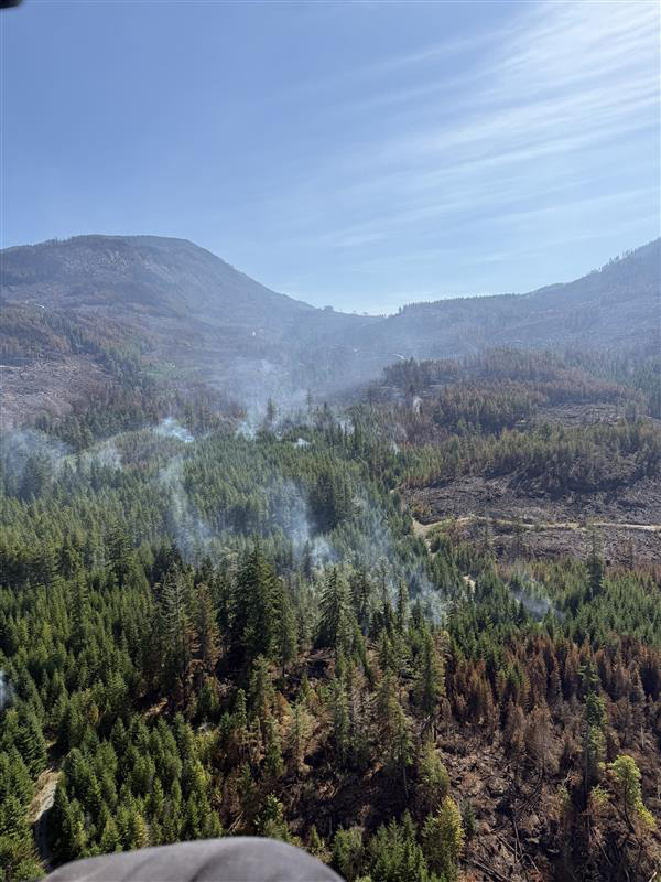
Since it emerged just before 6:30 p.m. on Aug. 11, Mount Underwood raged across the slope at a speed not seen in many years on Vancouver Island. After less than a week it grew to over 3,600 hectares, but almost 40 millimetres of rain has fallen on the forest fire since, enabling BC Wildfire crews to fully contain its perimeter and classify it as “being held”. Currently 151 firefighters are assigned to the blaze, with five helicopters, a dozen pieces of heavy equipment and danger tree fallers.
“Mop up and patrol is ongoing which involves digging into the forest floor to expose and extinguish smoldering hot spots,” stated the BC Wildfire Service in an update on Aug. 25. “Crews will continue direct attack tactics, working to extinguish all hotspots within 100 feet of the fire’s edge around the entire perimeter.”
Bamfield Main, the road from Port Alberni to the Barkley Sound community, runs right through the area affected by the forest fire. An update from the B.C. Ministry of Transportation and Transit indicates that damage to this road is more serious than many had anticipated.
“Falling rocks, dangerous trees and a fire-damaged slope are presenting exceptionally challenging conditions, and there is no timeline for reopening the road in its current condition,” stated the press release. “Further technical assessment is required to determine the timeline for any immediate fix to provide public access.”
“There is substantial work necessary over the coming weeks and months ahead to reopen Bamfield Road,” noted Minister of Transportation Mike Farnworth in the government release.
Fifteen kilometres of Bamfield Main is overseen by Mosaic Forest Management, which owns private timber land in the area. The damaged terrain is within this stretch of road, a route that initial engineering assessments have determined is “unsafe for all traffic”, according to the ministry. Currently the affected area isn’t even deemed safe enough for Mosaic to get in there and establish a timeline for slope reparation and road repairs.
“Based on initial assessments, BC Wildfire Service has determined the road is currently unsafe for all transit,” said D’Arcy Henderson, Mosaic’s chief operating officer. “Safety remains our top priority in all decisions.”
The indefinite road closure forces those in the remote communities south of Port Alberni to rely on a series of logging roads that begin at Youbou on the western half of Lake Cowichan. After visitors were discouraged from coming to the area over the first week of the forest fire, Bamfield businesses are inviting tourists back, but with warnings about using the forest service roads to the destination. Travellers are advised to prepare for the unexpected, as cellular service is unreliable on the route, which demands a keen focus on the bumpy, dusty road.
“Ensure you have at least one spare tire, and that you know how to change it,” cautions the Alberni-Clayoquot Regional District. “Make sure your gas tank is full, so you are prepared should something go wrong.”
“Drivers are asked to exercise caution, be prepared for driving on a gravel surface and give the right of way to industrial vehicles,” said the Ministry of Transportation.
In recent years the Ditidaht First Nation has seen large holes open in the section of the road near its community on Nitinaht Lake. The First Nation has called for the section to Youbou to be taken under provincial designation rather than its current patchwork of forestry tenures, private landowners and various levels of government.
“The Ministry of Transportation and Transit does not have jurisdiction over the secondary route. Ownership of the roads is mixed, but all are private industrial roads,” wrote in the ministry in an email to Ha-Shilth-Sa. “The province is working with the owners of these roads to support maintenance of the route until the primary road to Bamfield reopens.”
“Road maintenance is a wicked problem overlapping several jurisdictions—this has delayed remediation and sparked what we’ve heard called a ‘grader war,’” said Ditidaht Chief Councillor Judi Thomas. “Ditidaht First Nation continues to assert our inherent rights and title to this land. We urgently need action to maintain the road so emergency services can reach our people, visitors, and our neighbours.”
As Bamfield Main remains closed for the foreseeable future, the Ditidaht has secured a contract through provincial emergency assistance funding. This enables the First Nation to grade the logging roads to Youbou seven days a week, with flaggers at certain sections to direct traffic.